Note: All data on this website is very preliminary, has not been quality controlled and should not be used for research!
Please contact us for research-quality data
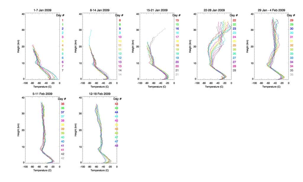
Temperature profiles from the twice daily radiosondes launched at Eureka
January 1- Feb 11 2009
The story so far: The 2008/2009 polar vortex started out cold and strong. The radiosonde profiles in early January show cold temperatures and low maximum heights (the totex rubber balloons get brittle in the cold and burst at lower-than-normal altitudes in very cold conditions). Things change dramatically around the 21st of January, when a sudden stratospheric warming beginning in the mesosphere a few days earlier caused the vortex to break apart and temperatures to get very warm. As of Feb 11, the vortex has remained split in the stratosphere, but is beginning to reform high up. Check out Lynn Harvey's website for a movie of the vortex, including the warming and break-up, and detailed descriptions of the current vortex status.